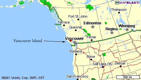
 Vancouver Island
Vancouver Island
Where the heck is this place and how is the weather!?!
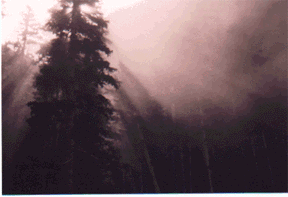
Vancouver Island is located in the south-western corner of Canada. Straddling the the 50th parallel, the climate is fairly temperate: pleasantly warm in the summer and a little bit damp in the winter. During the winter, a jet stream dubbed 'The Pineapple Express" dumps a lot of rain here. Some places on the island receive over 5 meters of rain a year! It is great for the local ski hills because all that rain amounts to a lot of snow.
The summers are very pleasant. The jet stream that brings us rain in the winter moves farther north in the summer time and the skies are nice and blue. June to September are generally quite warm with highs reaching 25 degrees Celsius and occasionally the low thirties.
Measuring over 500 km long, Vancouver Island is not a small island by any means! The terrain is very diverse too. The centrally located Strathacona Park is full of rugged peaks and pristine Valleys. It is the oldest Provincial Park in British Columbia. Many other parts of the island are very famous. Tofino, the West Coast Trail, Victoria and Nootka Sound are very popular areas to visit.
The West Coast Trail attracts over 8000 people a year from all over the world! The 77 km long trail boast some of the most rugged coastal hiking in the world. It is unfortunately heavily used and lost some of its ruggedness; staircases now line the sides of the steepest valleys.
Luckily though, most of Vancouver Island is still undamaged wilderness (and we want to keep it that way!) with many possibilities. Most of the northern and western halves of the island contain few roads and few people. Remote wilderness is as close as it should possibly be!
How to get there:
There are only two ways to get to the Island: ferry or plane. BC Ferries runs many regularly ferries between Vancouver and Vancouver Island as well as two other locations. Check their website at www.BCFerries.ca for the most recent schedule. Time to sail across Georgia Straight from Horseshoe Bay to Departure Bay in Nanaimo is about 95 minutes. From Tswassen to Duke Point in Nanaimo is about 2 hours.
Vancouver to Nanaimo is the most common route to get to the Island from the mainland, but there are three other possible sailing route as well: Powell River to Comox, Vancouver to Victoria and Prince Rupert to Port Hardy.
If I can suggest two things for the ferries, the first would be to leave lots of time to catch a sailing if you are planning on traveling on a long weekend. Two sailing waits, about 4 hours, are not uncommon on some statutory holidays. The second suggestion is to have money on you, you can only pay cash for the ferry tickets.
Any other questions about BC Ferries can probably be answered at the BC Ferries FAQ page.
The other way of getting to the island is by plane. Most towns and all the cities have airports, but the flights are generally routed through Vancouver Regional Airport.
Places to go hiking:
Here are some places that are great to go hiking at. Hikes from beginner to export, you'll find anything you're looking for like ice climbing to snow camping. There's a little bit for everyone here.
| Rugged Mountain | Comox Glacier | Recommended Books and Maps |
| Mt Arrowsmith | Forbiden Plateau | The Ramparts |
| Tennet Lake | To purchase photographs |
Cities and towns on the Island:
Here are links to Vancouver and some of the towns and cities on Vancouver Island. The link will take you to their tourism or commerce web pages.
| Campbell River | Comox Valley |
| Nanaimo | Port Alberni |
| Port Hardy | Vancouver |
| Victoria | Tofino |
| Zeballos |
This page is best viewed with 1024 X 768 resolution