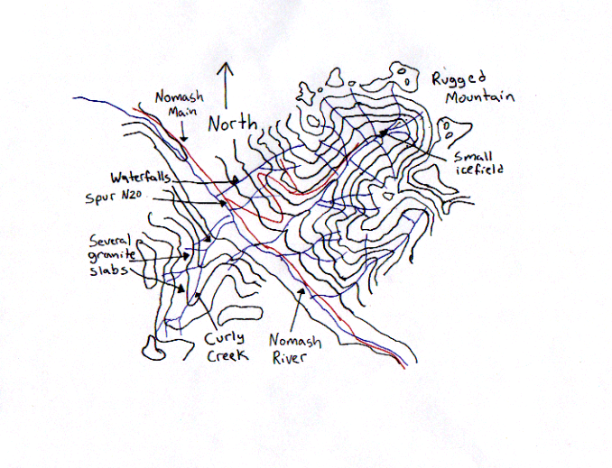
| Legend | Notes Updated November 2001 |
| Black lines: 500 ft interval contour lines. Lowest contour line is 500 feet abouve sea level; highest is 5500 feet. | Spur N20 is in very rough shape. Do not attempt to drive up it even if you have a 4WD vehicle. A few hundred meters up the road, there is a rock fall that blocks it and there is very limited turn around area. |
| Blue lines: Rivers or streams | The bears are very active in this area, but should begin hibernation in the next several weeks. Be careful, especially when vision is limited in alder trees. |
| Red lines: Gravel road | Several blue ribbons occasional mark the route up. |
| Scale: Approximately 1:50 000 | Spur N20 is grown over with 7 foot high alder trees in many areas. |
![]()